
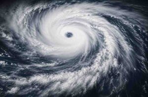
The United States Pacific territories are bracing for the arrival of Super Typhoon Bavi, an exceptionally powerful tropical cyclone that has intensified into a Category 5-equivalent storm over the western Pacific Ocean. With sustained winds reaching nearly 280 kmph, meteorologists have warned that the cyclone poses a severe threat to lives, infrastructure and essential services across vulnerable island communities.
The storm has rapidly strengthened over warm ocean waters, becoming one of the most intense weather systems of the 2026 Pacific typhoon season. Weather agencies continue to monitor its movement closely as it advances toward the Northern Mariana Islands, where emergency measures have already been activated.
Authorities Issue Urgent Warnings
Officials across the affected islands have urged residents to complete emergency preparations and remain alert to official advisories. Local authorities have warned that the combination of destructive winds, heavy rainfall and powerful waves could create life-threatening conditions, especially in coastal and low-lying areas.
Emergency shelters are being readied, while disaster response teams have been placed on standby. Residents have also been advised to secure homes, stock emergency supplies, charge communication devices and avoid unnecessary travel as weather conditions continue to deteriorate.
Authorities have stressed that people living in flood-prone or coastal communities should be prepared to evacuate if required.
Category 5 Strength Raises Serious Concerns
Meteorologists classify Bavi as a Category 5-equivalent super typhoon based on its sustained wind speeds, placing it among the strongest tropical cyclones capable of developing over the Pacific Ocean.
At this intensity, the storm is capable of causing catastrophic structural damage, uprooting trees, destroying power infrastructure and disrupting communication networks. Strong winds can also generate dangerous airborne debris, significantly increasing the risk of injuries.
Experts note that storms of this strength often produce widespread destruction even if the eye of the cyclone does not pass directly over populated islands.
Heavy Rainfall and Storm Surge Expected
Beyond the extreme winds, forecasters expect Bavi to bring intense rainfall capable of triggering flash floods and landslides in elevated terrain. Rivers and streams may overflow rapidly, while prolonged downpours could isolate several communities.
Marine conditions are also expected to worsen considerably. Powerful waves and storm surge may inundate coastal areas, threatening homes, ports and transportation infrastructure.
Fishing vessels and commercial shipping have been advised to remain in safe harbour until the storm passes.
Emergency Response Teams on Alert
Government agencies and disaster management authorities are coordinating emergency response efforts across the region. Medical teams, rescue personnel and utility workers have been mobilised to respond quickly once conditions allow.
Airports, schools and government offices may suspend operations depending on the storm’s final track and intensity. Authorities are also preparing for possible disruptions to electricity, drinking water and telecommunications.
Officials have encouraged residents to monitor weather updates regularly rather than relying on rumours or unverified social media information.
Storm Track Closely Monitored
Forecast models indicate that Bavi will continue moving westward across the Pacific while maintaining significant strength. However, meteorologists caution that tropical cyclones can change direction or fluctuate in intensity depending on atmospheric and oceanic conditions.
Even relatively small shifts in the projected path could significantly alter which islands experience the strongest winds and heaviest rainfall.
Weather agencies are therefore issuing continuous updates as new satellite observations and forecast data become available.
Also Read: Active Monsoon Triggers Heavy Rainfall Across India, Multiple States On Alert
Lessons From Previous Pacific Super Typhoons
The Pacific Ocean frequently experiences some of the world’s strongest tropical cyclones, many of which have caused extensive damage across island nations and coastal regions in East Asia.
Previous super typhoons have demonstrated how rapidly such systems can intensify over warm ocean waters before producing widespread destruction through violent winds, flooding and storm surge.
Disaster experts emphasise that early preparation remains the most effective way to reduce casualties and property losses during major tropical cyclones.
Residents Urged to Remain Prepared
Authorities continue to advise residents to keep emergency kits ready with drinking water, food supplies, medicines, flashlights, batteries and important documents. Families have also been encouraged to establish communication plans in case phone networks become disrupted.
People have been reminded not to venture outdoors during the height of the storm and to wait for official confirmation before returning to affected areas after the cyclone passes.
As Super Typhoon Bavi advances toward the US Pacific islands, emergency agencies remain on high alert. The coming hours are expected to be critical as officials monitor the storm’s movement and prepare for its potentially devastating impact.
Click here to join us on WhatsApp Channel and get all the latest news updates